Friday, January 7, 2011

Lifespan of a Road Sign


Sign to Seattle's Alaskan Way Viaduct

It's not often that something roadgeek-worthy makes it to TV news. This won't be extremely geeky as it is produced for the general public. Now from the middle of the country, Brad's Beat: Lifespan of a Road Sign.


Sunday, August 8, 2010

What's Your Sign?

Beside finding the Roadgeeky details of how signs, signals and road markings should look, now you can test your skills at the Federal Highway Administration's Sign IQ Quiz.
Want to know more? You can download the official Manual on Uniform Traffic Control Devices here. Then go and see how well your local roads follow the manual.


Tuesday, May 25, 2010

Road Stripe Shortage could have Texas Drivers Weaving

A stripe paint shortage has the Texas Department of Transportation scrambling to find new sources of paint for roadwork already scheduled. More from KVUE TV in Austin.
Here's the Top Ten Ideas for Striping Texas Highways.
  • #10 Arrest Spray Paint Taggers and put them on the road gang
  • #9 Start a Jobs program for out of work Painters. 
  • #8 Field Trips for Art Students 
  • #7 Now that DVDs have taken over… use old rental video tape. 
  • #6 Junior High Kids with big shoes and to-go mustard packets 
  • #5 Yellow Duct Tape 
  • #4 Specially Trained Seagulls dropping in... Droppings! 
  • #3 Delay openings 'til fall and use yellow and orange leaves 
  • #2 Re-use Crime Scene yellow tape.
  • #1 Forget the stripes and drive crazy like overseas.
Links
Free Texas Map
Downloadable Texas Map
Texas Atlas and Gazetteer
Going to Texas: Five Centuries of Texas Maps
The Roads of Texas - 5th Edition


Saturday, January 16, 2010

Free NC Map

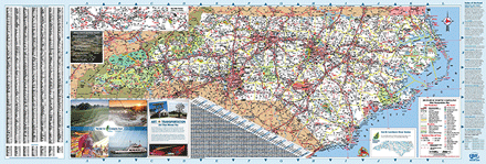
Get yourself a free North Carolina Road Map here. Paper or PDF and GIF files.
While you are there, look at the wonderfully detailed scans of archived road maps going back to 1922. This can be very helpful when scouting out old highways and finding the pre-interstate routes around North Carolina. There's also a history of the publication of the North Carolina State Maps.


Links
Free North Carolina Maps
Buy the North Carolina Atlas & Gazetteer
Buy the American Map North Carolina State Road Atlas


Thursday, December 31, 2009


courtesy AARoads Shield Gallery
Make your own Shield at the AARoads Shield Generator

Monday, August 31, 2009

Where are we now?

No, we're not in Minnesota.


The shovel shaped sign is a clue.


US President Herbert Hoover once lived here.


We're in Newberg Oregon on Oregon 99W, also known as the Portland Road, formerly known as US99 and US99W.

It’s still called the Herbert Hoover Highway in honor of the 31st President. Hoover spent time in Newberg as a college student at Friends Pacific Academy which became George Fox University. The house he lived in, The Hoover-Minthorn House, is now on the National Register of Historic Places.

By whatever name you call the road, this section of 99W is a great mix of different road construction eras. In some areas the older northbound lanes goes up and down and around sharp curves with the natural landscape. Meanwhile the mostly parrellel southbound lanes are flat and have broad curves of a later era. Not too much has changed in the allignment of 99W since I-5 was built in a new location splitting the difference of 99W and 99E.

A rare sight is an operating drive-in movie theater. The 99W Drive-In has been around since 1953. They have an on-site indoor theater which may have helped them stay around.

99W is still the main thouoghfaire through the area. It’s often jambed with traffic especially when it drops to a two-lane road though Dundee. There is a plan to bypass both Newberg and Dundee with a new road.


Links
Order a free Oregon Highway map and see others
More Historic Places in Yamhill County
99W on Wikipedia

History of 99W Drive-In
Book: That Ribbon of Highway III: Highway 99 Through the Pacific Northwest
Book: Oregon Off the Beaten Path

Tuesday, July 7, 2009

More than just a Bicycle Map

Once in a while you find something road geeky when you least expect it. I was at the library last week and saw a free map. Besides being a Road Geek, I’m also a Map Geek. I think it may be in my genes. During one our family’s mini-semi-irregular-family reunion my Father, Brother and I were in the living room. Our wives were elsewhere. Without prompting from any external or internal sources, all three of us were looking at maps. As usual I digress.

The map was the Washington (State) Bicycle Map 2008. Never being one to turn down a free map, even a map I don’t “need”. After all, I can’t remember the last time I was on a bike. It probably involved minor injuries, which may be why I have blocked it from my memory.

I opened the map and found the usual Washington State map from the Department of Transportation, highlighted with bicycle trail information. It showed the freeway sections closed to bicycles, highways with dangerous narrow shoulders, and the real highlight for this geek… color coded from hot red to cold blue, the highway’s average daily traffic. I’ll admit knowing that up to 2000 cars travel daily on US101 between Forks and Humptulips, Washington probably doesn’t make for exciting conversation. However, for the road geek, or map geek, or maybe even a cyclist… enjoy… but please, wear a helmet.


Links
View the Washington State Bycycle Map
Bicycling in Washington from the WSDOT
Forks is the home of the movie Twilight
More Bicycle Maps